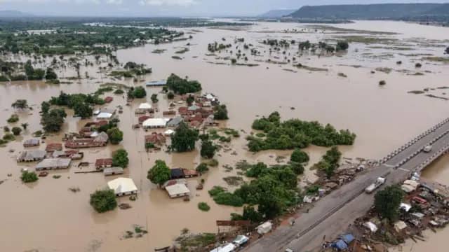
The Federal Government has sounded the alarm over an impending wave of severe flooding, placing 27 states and the Federal Capital Territory (FCT) on high alert. According to the Nigeria Hydrological Services Agency (NIHSA), no fewer than 739 communities across 162 Local Government Areas (LGAs) are expected to experience significant flooding between July 22 and August 5, 2025.
The warning, issued on Tuesday by NIHSA’s Director-General Umar Mohammad, is based on new hydrological data derived from the agency’s 2025 Annual Flood Outlook (AFO), which was first published in April. These forecasts indicate an imminent surge in river levels and runoff due to persistent rainfall across the country, raising concerns of widespread inundation.
“We are facing a critical two-week window where flood risk is significantly elevated,” Mohammad said. “The forecasts show heightened water levels in rivers and low-lying regions, and we are urging state governments and at-risk communities to prepare immediately.”
Key Areas on High Alert
The states identified as most vulnerable span nearly all geopolitical zones, underscoring the nationwide nature of the threat. They include:
Adamawa, Akwa Ibom, Anambra, Bauchi, Bayelsa, Benue, Borno, Cross River, Delta, Ebonyi, Edo, the FCT, Gombe, Imo, Jigawa, Kebbi, Kogi, Kwara, Lagos, Nasarawa, Niger, Ogun, Ondo, Plateau, Rivers, Sokoto, Taraba, and Yobe.
Lagos, Nigeria’s commercial capital, and Abuja, the nation’s administrative hub, have both been placed on NIHSA’s flood watchlist due to the potential for urban flooding and stormwater overflow in densely populated areas.
“Residents of low-lying and flood-prone areas in these states should be on high alert,” Mohammad cautioned. “We anticipate disruptions to homes, businesses, roads, and other critical infrastructure.”
Major Roads, Farmlands at Risk
NIHSA’s statement also flagged over 100 critical road corridors as likely to be impacted by floodwaters. Among the affected routes are:
• Okene–Lokoja–Abuja Expressway
• Birnin Kebbi–Bunza Road
• Ibi–Wukari Road, among others.
These routes serve as key arteries for the transportation of food, fuel, and essential goods, raising fears of nationwide logistical disruptions.
Even more concerning is the potential threat to agricultural productivity. With many farms situated near riverbanks or on floodplains, there is a significant risk that crops could be washed away at a time when Nigeria is grappling with rising food prices and supply-chain instability.
“Flooding at this scale could lead to the loss of thousands of hectares of farmland,” Mohammad noted. “This would further strain our already fragile food security situation and drive inflation in food prices.”
Call for Emergency Preparedness
NIHSA is urging state emergency management agencies, local authorities, and community leaders to activate flood response protocols immediately. These include the clearance of drainage systems, early warning broadcasts, pre-positioning of relief materials, and evacuation planning for high-risk zones.
Residents in affected LGAs are also advised to monitor flood advisories closely, avoid walking or driving through floodwaters, and relocate temporarily if instructed by emergency officials.
To stay informed, NIHSA encourages the public to follow updates via its official flood monitoring dashboard at www.nihsa.gov.ng and its verified social media channels.

